A Guide to Exploring California’s Saddlebag Lake Loop

Saddlebag Lake Loop
Saddlebag Lake Loop is part of Inyo National Forest near the eastern border of Yosemite National Park. The trail is celebrated for its rugged beauty and alpine terrain. The loop spans approximately 11.5 miles and climbs 2,200 feet in elevation, offering breathtaking views of Saddlebag Lake, Silver Lake, and a panorama of the Sierra Crest and Mono Craters. It's a path that weaves through the High Sierra, presenting landscapes akin to the iconic vistas found within Yosemite itself, making it an unforgettable hike for those exploring the area. With the best conditions from July to September, when the trail sheds its snowy facade, hikers can enjoy the full splendor of the Twenty Lakes Basin.
Trailhead and How to Get There
Accessing the Saddlebag Lake Loop begins at the trailhead located in the scenic Inyo National Forest, near the East Entrance of Yosemite National Park. Here's a guide on how to get there and what facilities you can expect:
Driving Directions:
Trailhead Facilities:
Local Services:
Nearest Towns: Lee Vining, CA, offers basic amenities such as food, fuel, and lodging. For more extensive services, including a hospital, Mammoth Lakes, CA is a viable option 3.
Permit and Contact Information: For any inquiries or required permits, the Mono Basin Scenic Area Visitor Center can be contacted at (760) 924-5500, and Wilderness Permit Information is available at (760) 873-2483 3.
The road to Saddlebag Lake is somewhat rugged, with certain sections only wide enough for one car, so driving cautiously is advised. The trailhead's high altitude location at over 10,080 feet means weather conditions can impact access, generally open from June to October. Always check current conditions before planning your trip to ensure the road and trail are open.
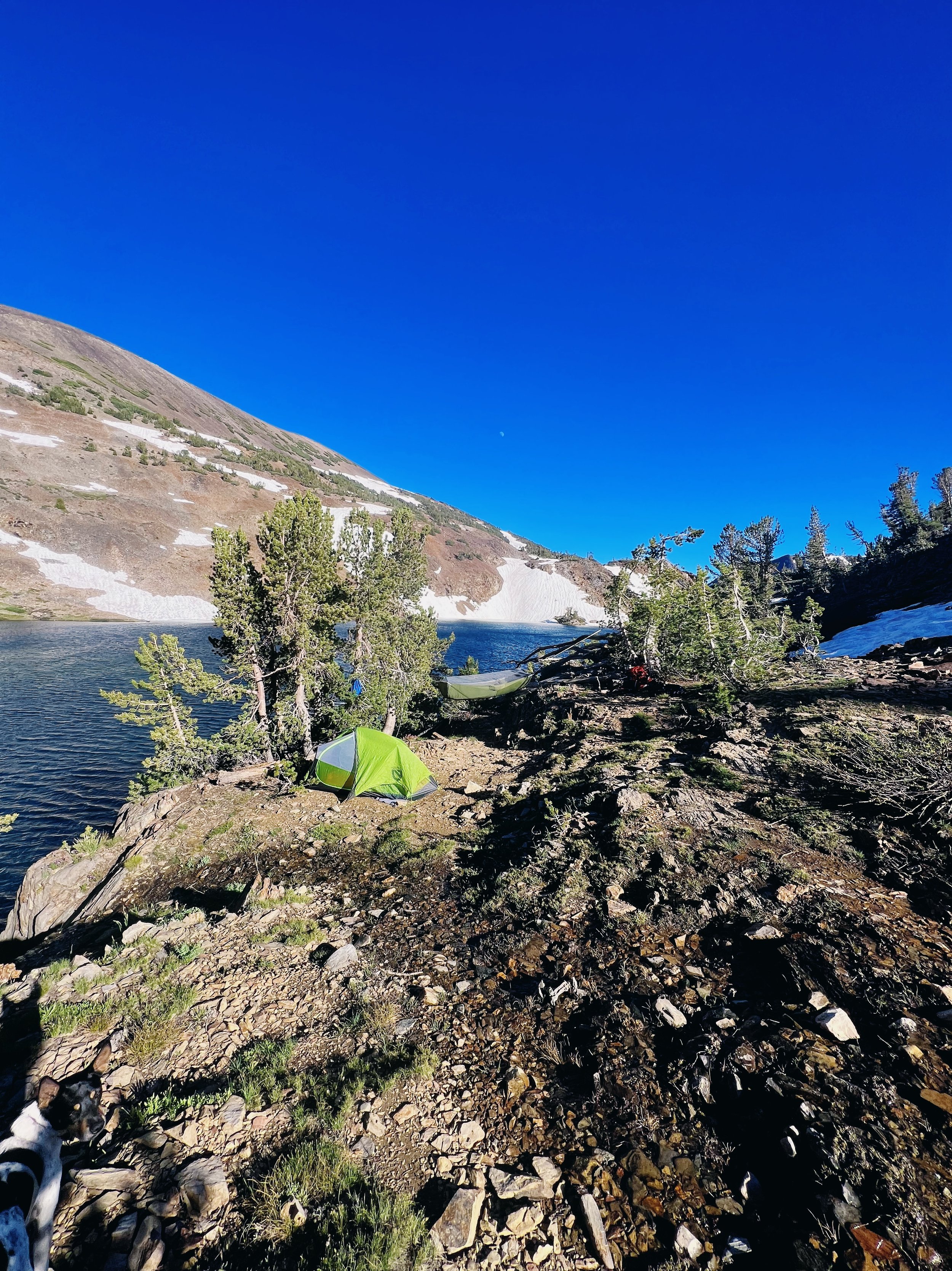
Camping and Regulations
Permits and Restrictions:
An overnight permit is required for backpacking in the Inyo National Forest, accessible via reservation on recreation.gov. No fees are charged for day hiking in this area.
Specific wilderness permits are mandatory year-round for overnight stays in designated wilderness areas like John Muir, Ansel Adams, and others. These can be reserved online and are crucial for maintaining the area's natural beauty and sustainability.
Camping is strictly allowed only in designated campsites to minimize environmental impact. Notably, campfires are prohibited in the 20 Lakes Basin and Harvey Monroe Hall Natural Area to preserve the natural habitat.
Camping Sites and Facilities:
The Saddlebag Lake Campground near the dam offers basic amenities including potable water and pit toilets. It's suitable for individual campers or small groups.
For larger groups, the Trailhead Group Campsite accommodates up to 25 people, providing a communal camping experience.
All food, trash, and scented items must be stored in bear-proof containers or counter-balanced to protect wildlife and ensure camper safety.
Wilderness Conduct:
Campers and hikers are urged to follow Leave No Trace principles to help keep the area pristine and non-quota. This includes proper disposal of human waste, treating water from natural sources before drinking, and respecting wildlife habitats, especially the recovering Sierra Nevada bighorn sheep populations.
These regulations are in place not only to ensure the safety and enjoyment of visitors but also to protect the delicate ecosystems of the Inyo National Forest and its surrounding areas. For more detailed information or specific inquiries, the Mono Basin Scenic Area Visitor Center and Wilderness Permit Information can be contacted.

Wildlife and Fishing Opportunities
Wildlife Sightings:
The trail is a haven for various wildlife species, making each hike a unique opportunity for animal watching. Commonly sighted animals include marmots, pikas, and deer, which are often spotted in the meadows and rocky outcrops.
Bird enthusiasts might catch a glimpse of majestic bald eagles soaring above or hear the distinct calls of local birds.
For those hiking deeper into the wilderness, there's a chance to spot mule deer and coyotes, adding a thrilling element to the adventure.
It's important to tread softly and respect the Sierra Nevada bighorn sheep habitats which are critical for the conservation of this endangered species.
Fishing Opportunities:
Saddlebag Lake and its surrounding waters offer rich fishing grounds teeming with various trout species. Anglers can look forward to catching rainbow, brown, and brook trout.
The lake itself is a popular spot for trolling, and shore access is conveniently available via a trail encircling the lake.
Key fishing spots around Saddlebag Lake include the inlet, the dam, and Jennifer's Point on the east side of the lake.
Beyond the lake, Saddlebag Creek and the 20 Lakes Basin provide serene fly fishing settings, with golden and brook trout being the common catches.
Fishing Regulations:
Anglers aged 16 and older must have a valid California fishing license. The area allows a daily bag limit of five trout per person, with each fish measuring at least 7 inches. Both artificial lures and bait are permitted, though no more than two lures may be used simultaneously.
Practical Tips for Visitors:
The use of bear spray is recommended as bears are known to inhabit the area, ensuring safety for both the wildlife and hikers.
Trail Highlights
Embarking on the Saddlebag Lake Loop offers a series of captivating natural highlights and challenging terrains. Here are some of the key features and tips for navigating this scenic trail:
Key Trail Features:
High Altitude Lakes: The loop passes by several stunning high-altitude lakes, including Greenstone, Steelhead, and the picturesque Kness Lakes, which are noted for their exceptional beauty.
Navigational Tips:
Direction: Although the trail can be hiked in either direction, hiking it clockwise is recommended to tackle the steeper sections earlier in the journey.
Water Crossings: Be prepared for significant water crossings, especially on the north side of the lake, where hikers are likely to get wet.
Wildlife and Safety: Carrying bear spray is advised due to the presence of bears in the area.
Scenic Points:
North Peak: For those seeking a vigorous challenge, North Peak offers a rewarding scramble. Rising to 12,200 feet, it provides exhilarating views once you conquer the 1,600-foot ascent from the trail.
Exploring The Loop
Trail Description and Difficulty:
Length and Elevation: The full loop spans about 11.5 miles and climbs 2,200 feet in elevation.
Morning to Afternoon Hike
Starting Point: Begin at Saddlebag Lake Trailhead.
Distance to Greenstone Lake: 2 miles.
Elevation Change: +276 ft, -255 ft.
Afternoon Trek: From Greenstone Lake to Conness Lakes.
Distance: 1.5 miles.
Elevation Change: +747 ft, -82 ft.
Full Day Exploration - Twenty Lakes Basin Loop
Route: Start from Greenstone Lake and circle back to the same.
Key Lakes Visited: Wasco Lake, Steelhead Lake, Excelsior Lake, Shamrock Lake, Helen Lake, Odell Lake, Hummingbird Lake, and ending at Greenstone Lake.
Total Distance: 4.5 miles.
Elevation Changes: +807 ft, -791 ft.
Trail Options and Challenges
North Shore Route: Longer but easier trail, less rocky and more navigable.
South Shore Route: Shorter route filled with scree and challenging terrains, suitable for those looking for a more strenuous hike.
Flora, Fauna, and Scenery
Flora and Fauna Highlights:
The Saddlebag Lake Loop is a sanctuary for diverse wildlife and vibrant wildflowers. Hikers can enjoy the sight of marmots along the trail, adding a playful element to the natural scenery.
Mammals such as the mule deer and pine marten also inhabit this area, offering hikers occasional glimpses of these elusive creatures.
Bird watchers will be delighted by the presence of species like the mountain chickadee, Clark's nutcracker, and Williamson's sapsucker, enhancing the auditory experience of the hike.
Scenic Vistas:
The trail provides stunning panoramic views that encompass Saddlebag Lake, alpine meadows, and towering peaks such as Silver Peak and North Peak.
Each turn and climb along the loop reveals new vistas, making it a visually rewarding experience for nature lovers and photographers alike.
FAQs
1. How can one access Saddlebag Lake?
Saddlebag Lake is accessible by either taking the water taxi from Saddlebag Lakes Resort or hiking the trail around the lake. To get there, drive on Highway 120 (Tioga Pass Road) about 12 miles from the junction with Highway 395 to Saddlebag Lake Road. Continue for about three miles on Saddlebag Lake Road to reach the lake.